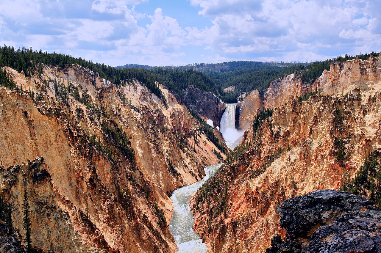
Mount Washburn is the hike that shows Yellowstone's shape. From the Dunraven Pass trailhead, 4.5 miles north of Canyon Junction, a wide old road climbs steadily for about three miles (6 miles round trip) to the summit at 10,243 feet, where a staffed fire lookout tower stands with an interpretive shelter at its base. From the top, the park lays out like a relief map: the broad rim of the Yellowstone Caldera, the Grand Canyon of the Yellowstone cutting below, Yellowstone Lake to the south, the Absaroka Range to the east and, on clear days, the Teton peaks on the far southern horizon. The route is rated strenuous by the park, mostly because of altitude and steady gain, but the grade is consistent and the trail wide, so fit hikers of most ages complete it in three to six hours. In midsummer, the alpine meadows explode with wildflowers, and the slopes are among the best places in the park to see bighorn sheep, often close to the trail. Grizzlies frequent the area, especially in fall when they feed on whitebark pine nuts, so the park advises hiking in groups of three or more, making noise and carrying bear spray. There is no water along the way, and afternoon thunderstorms bring lightning danger above the trees. Seasonal honesty: Dunraven Pass is among the last park roads to open in late spring and closes in autumn (it closed for the season after October 31, 2026), so this is a summer and early-autumn hike only. Fit: outdoors lovers, first-time visitors who want one big hike, wildlife watchers hoping for bighorns, and older kids with stamina.
The mountain is named for Henry Washburn, who led the 1870 expedition whose reports helped build the case for creating the national park two years later. Geologically, it is a remnant of an older volcano that predates the caldera, which is why the summit view makes the caldera's scale so legible. The lookout is one of the park's active fire lookouts, and the shelter at its base has exhibits and a viewing area where hikers can shelter from wind.
To hike well, start early to beat both the heat and the afternoon storms, which build quickly in July and August; if you hear thunder, descend. Carry plenty of water, sun protection, layers (the summit can be cold and windy even in summer) and bear spray. Give bighorn sheep space even when they wander close. Stay on the trail to protect the fragile alpine plants. The park does not allow pets on the trail.
Practicals and fit
Trailhead at the Dunraven Pass parking area on the Tower-Canyon road, which opens in late spring and closes in autumn; check opening dates before planning. A second trailhead on the north side, at the end of Chittenden Road, offers a different approach. Park entrance fee applies. Pair it with the Grand Canyon of the Yellowstone below or a late-day drive into Hayden Valley. Fit: hikers, first-timers wanting a summit, and wildlife lovers in summer.
What to expect
The experience
A steady, wide-trail climb of about three miles each way from Dunraven Pass to a summit fire lookout with an interpretive shelter and a panoramic view.
Best time
July and August for wildflowers; early mornings to avoid thunderstorms. Summer and early autumn only, when Dunraven Pass is open.
How long
Three to six hours round trip.
Tips
Start early and descend at the first thunder. Carry water, layers and bear spray, and hike in a group. Give bighorn sheep space.
Quick picks
- Best for
- One big summit hike with the whole park spread below.
- Families
- Good for fit kids used to hiking; altitude makes it harder than the distance suggests.
- Couples
- An early start, a summit view and lunch at the lookout.
- Pair with
- Grand Canyon of the Yellowstone and Hayden Valley.
- Time needed
- Half a day, north of Canyon Junction.
Good questions
How long is the Mount Washburn hike?+
About 6 miles round trip from the Dunraven Pass trailhead, taking three to six hours. The park rates it strenuous.
Can I hike it in November or winter?+
No. The road over Dunraven Pass closes for the season in autumn and opens in late spring, so this is a summer and early-autumn hike.
Will I see bighorn sheep?+
Often. The slopes of Mount Washburn are one of the best places in the park to see bighorn sheep, sometimes very close to the trail.
What is at the summit?+
A fire lookout with an interpretive shelter at its base and a panoramic view of the caldera, the canyon, Yellowstone Lake and distant ranges.
Is there water on the trail?+
No. Carry all the water you need, plus layers for a cold, windy summit and bear spray.