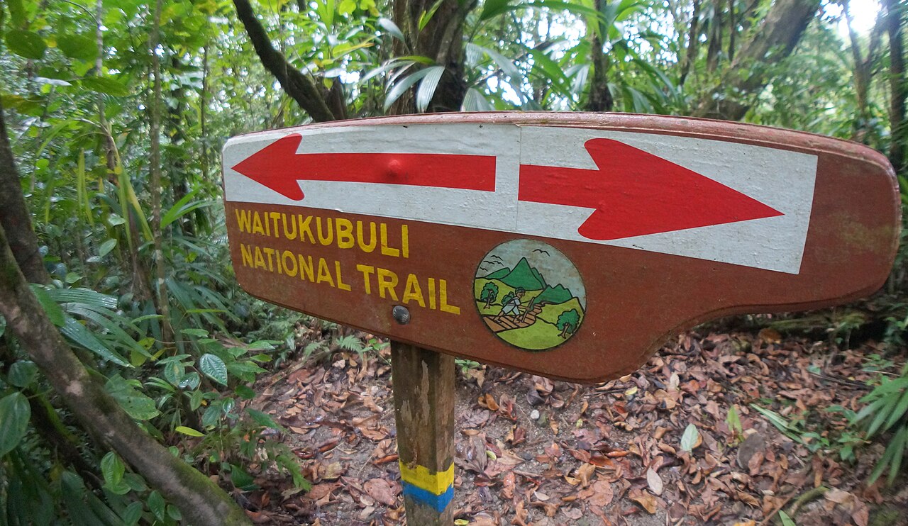
The Waitukubuli National Trail is the Caribbean's longest walking route. Opened in stages, it links old village paths, forest tracks and coastal trails along the whole of Dominica, from the dramatic headland at Scotts Head to the historic Cabrits National Park in the north, a distance of about 184 km. It is divided into fourteen numbered segments, each designed as a day hike, so you can sample one or string together a thru-hike of two weeks. The name is the Kalinago name for the island, meaning tall is her body. Walking it takes you through villages, banana farms, rivers and cloud forest, and it is the best way to meet the island at walking pace. Segment 1, from Scotts Head to Soufriere, is the most popular for first-timers, and segments at either end of the trail suit single-day visits.
Most visitors do not attempt the whole trail. A typical plan is to pick one or two segments, hire a local guide for the day and arrange transport at each end. Segments 1 and 2 in the south, and 13 and 14 in the north, are usually recommended for day visits, while the interior segments are longer, tougher and better done with a guide. The longest, segment 9, can run to around eighteen kilometres.
Check current conditions before you go. Landslides and heavy rain can close sections, and signage can fade, so ask local operators or the Forestry Division about each stage. Some trail sections and national park sites require a site pass, and pass rules have been revised recently, so confirm before you walk. The trail passes through villages with simple guesthouses, which helps if you want to walk several days without carrying a tent.
Pack as you would for any rainforest hike: sturdy shoes, a rain jacket, plenty of water and a map or offline route. Start early, because afternoon showers are common and daylight ends around six. Walking the trail rewards you with quiet, long views and chance meetings with villagers, farmers and fellow hikers, far from the busy cruise sights. If you want an easy introduction, try the southern segment from Scotts Head, then finish with a swim and a plate of local food.
What to expect
The experience
A self-guided or guided walk along one or more of the fourteen trail segments, usually done one day at a time with transport arranged at each end.
Best time
The drier months from about December to April, with early starts to avoid afternoon rain.
How long
One segment takes a day; the whole trail takes about two weeks.
Tips
Ask about trail conditions before you start, take a guide for interior segments and carry water, rain gear and an offline map.
Quick picks
- Best for
- Walkers who want to see the island on foot beyond the headline sights.
- Families
- Choose a short, easy segment such as the southern coastal stage near Scotts Head.
- Couples
- A quiet, scenic day with a swim and a village lunch at the end.
- Pair with
- Champagne Reef and Scotts Head in the south, or Fort Shirley in the north.
- Time needed
- One day per segment.
Good questions
How long is the Waitukubuli National Trail?+
It is about 184 km long, from Scotts Head in the south to the Cabrits in the north. It is divided into fourteen segments.
Which segment is best for a first walk?+
Segment 1, from Scotts Head to Soufriere, is the most recommended for first-timers. Segments at either end are best for single days.
Do I need a guide?+
Easy southern and northern segments can be done independently by experienced walkers, but interior stages are better with a local guide. Conditions change, so ask locally.
Is a pass needed?+
Some sites and trail stages require a site pass, and the rules were revised in late 2025. Check the Forestry Division site before you go.
When should I go?+
The drier months from about December to April are easiest. Start early, as rain is common in the afternoon.