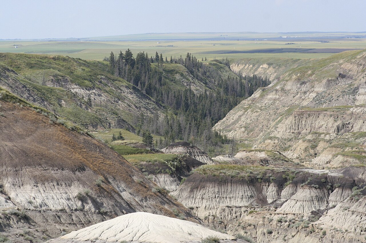
Horseshoe Canyon is the badlands picture most people have in mind, a broad U-shaped canyon with banded walls of sandstone, shale and coal, sitting right beside Highway 9 about 17 kilometres west of Drumheller. Travel Alberta says the rock layers date to the Cretaceous period, about 70 million years ago, and that the two arms of the canyon are each around five kilometres long. A gently sloping trail leads from the rim to the canyon floor, and viewing platforms at the rim suit anyone who prefers not to walk. The hike is self-guided and rated beginner to intermediate, and it takes one to two hours. In the right light, especially at sunrise over snow or in golden autumn grass, it is one of the most photogenic places in the province.
What to do
Walk down the trail, follow the interpretive signs and loop back up. One loop covers about 3.9 kilometres, according to Travel Alberta's Drumheller itinerary, and the signs matter because the side canyons look alike and it is easy to lose your bearings. Even a short visit to the rim platforms gives you the full sweep of the canyon. Photographers should come early or late, when low light picks out the colour bands in the rock.
Practical planning
Travel Alberta lists the canyon for spring, summer and fall, and does not list winter. The trail is dirt and clay, which turns slippery when wet and treacherous with snow or ice, so in November look from the rim first and descend only if conditions are dry. Wear sturdy shoes, carry water and keep to the marked path to protect the fragile slopes. There are no big facilities at the site, and the climb back up is the hardest part.
Fitting it in
The canyon is beside Highway 9, which is the route in from Calgary, so it makes an ideal first stop on the way into Drumheller or a last stop on the way out. It is free to visit, and it pairs well with the Hoodoos on the other side of town and with a late lunch in Drumheller. Allow at least an hour, and more if you plan to walk the full loop.
What to expect
The experience
A self-guided walk from the rim down a gentle trail into a U-shaped canyon, with viewing platforms for those who would rather stay up top.
Best time
Sunrise or late afternoon in dry weather, when low light brings out the colour bands in the canyon walls.
How long
One to two hours for the descent and loop, or twenty minutes for the rim platforms alone.
Tips
Wear sturdy shoes, carry water, stay on the marked trail and look from the rim first if there is snow, ice or rain.
Quick picks
- Best for
- Anyone who wants the classic badlands view with an easy walk attached.
- Families
- The gentle trail suits school-age children, but keep them close and remember the climb back up is the tiring part.
- Couples
- Walk the loop at golden hour, then head into Drumheller for dinner.
- Pair with
- The Hoodoos and the Royal Tyrrell Museum make a good full day with the canyon as the opener.
- Time needed
- One to two hours.
Good questions
Where is Horseshoe Canyon?+
It sits beside Highway 9, about 17 kilometres west of Drumheller, in Kneehill County. It is the first major badlands stop on the drive in from Calgary.
How hard is the hike?+
It is rated beginner to intermediate, with a gently sloping trail from the rim to the floor. The loop is about 3.9 kilometres, and the return climb is the toughest part.
Is it open in winter?+
Travel Alberta lists it for spring, summer and fall, and the trail can be icy in the cold months. View from the rim first and walk down only if conditions are dry.
Does it cost anything?+
No admission fee is charged that we could find. Bring your own water, because facilities are limited.
What am I looking at?+
The canyon walls are Cretaceous rock about 70 million years old, carved into a U shape with two arms each around five kilometres long.