The roads of southern Utah are attractions in their own right. The drive from Zion to Bryce Canyon takes you through a historic tunnel, past slickrock and red cliffs and onto a high plateau of ponderosa pine, and Scenic Byway 12 beyond Bryce is one of the great drives in America, crossing some of the most remote and spectacular terrain in the West. Here is how to make the most of it.
Leg one: Springdale to the East Entrance
From Springdale, enter Zion at the South Entrance and turn east at Canyon Junction onto the Zion-Mount Carmel Highway. The road climbs a series of switchbacks above Pine Creek and enters the Zion-Mount Carmel Tunnel, a 1930 engineering landmark listed on the National Register of Historic Places. Vehicles over the size limits — about 11 feet 4 inches high, 7 feet 10 inches wide or 35 feet 9 inches long for single vehicles — cannot use the highway between Canyon Junction and the East Entrance, and some large vehicles that fit need an escort. Just past the east portal, stop for the Canyon Overlook Trail, a one-mile round trip to a fenced viewpoint over the canyon. Then continue through the slickrock country of the east side, past Checkerboard Mesa, watching for bighorn sheep. The highway was closed by a major rockfall on September 30, 2026 and fully reopened on October 9, with repaving still to come, so check the park's alerts before driving.
Leg two: Mount Carmel Junction to Red Canyon
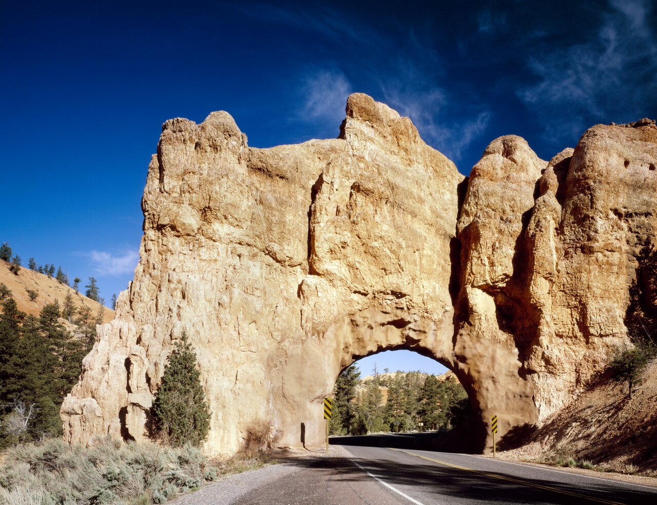
At Mount Carmel Junction, turn north on US 89, which follows the East Fork of the Virgin River and then the Sevier River through pastoral valleys and small towns. Kanab, to the south, is the hub for a longer loop that includes Page and Antelope Canyon in Arizona, the Vermilion Cliffs and the Grand Canyon's North Rim, but for Bryce, head north. Near Panguitch, turn east onto Scenic Byway 12. Within a few miles you enter Red Canyon in Dixie National Forest, where the road passes through two rock tunnels and brilliant red hoodoos stand among the pines. Stop at the visitor center if it is open, walk the short Pink Ledges Trail, or cycle a stretch of the paved bike path. There is no entrance fee.
Leg three: Bryce Canyon
About 13 miles beyond Red Canyon, turn south on State Route 63 into Bryce Canyon City and the national park. Spend at least a day: sunrise at Bryce Point or Sunrise Point, the Rim Trail between the main viewpoints, the hike down Queen's Garden and up the Navajo Loop, and the 18-mile drive to Rainbow Point. Stay in Bryce Canyon City, at the park's gate, or in Tropic, below the rim on Byway 12.
Leg four: Tropic and Kodachrome Basin
East of the park, Byway 12 drops off the plateau to Tropic, a small farming town with views back up to the Pink Cliffs, a few restaurants and lodging including Stone Canyon Inn. Continue to Cannonville and turn south on paved Cottonwood Canyon Road for about nine miles to Kodachrome Basin State Park, where white sand pipes stand in front of banded red and cream cliffs. Walk the nearly level Panorama Trail, about three miles, and if the road is dry and your vehicle suitable, continue to Grosvenor Arch on the unpaved road beyond. This area sits at the edge of Grand Staircase-Escalante National Monument, a vast landscape of canyons and plateaus managed by the Bureau of Land Management.
Leg five: Escalante and Lower Calf Creek Falls
Back on Byway 12, the road climbs over high benches with views across the monument to the small town of Escalante, where the interagency visitor center offers maps and road conditions. Fifteen miles further east, the Calf Creek Recreation Area is the trailhead for Lower Calf Creek Falls: a six-mile round trip through a lush canyon past ancient granaries and rock art to a 126-foot waterfall. There is a small per-vehicle day-use fee. Beyond, the byway crosses the Hogsback, a narrow ridge with steep drop-offs on both sides, before descending to Boulder and continuing toward Capitol Reef National Park.
Road trip practicalities
Fill your tank whenever you can — stations are sparse between towns, especially in winter, when some businesses close. Download offline maps, as mobile coverage is patchy. Watch for deer, pronghorn and cattle on the roads, especially at dawn and dusk. Allow plenty of time: the scenery invites stops, and the distances are longer than they look. In winter, Byway 12 and US 89 can be icy or snowy, and the high sections near Bryce may close briefly in storms; carry warm clothes, water and snacks. Utah observes daylight saving time while most of Arizona does not, so watch your clocks if your trip continues south to Page.
Suggested pacing
For a relaxed trip, allow a day for Zion's east side and the drive to Bryce, a day at Bryce, and a day for Kodachrome Basin and Lower Calf Creek Falls, staying in Tropic or Escalante. If you are heading back to Las Vegas, consider a return via Cedar City and I-15, with stops at Kolob Canyons and Snow Canyon State Park near St. George. However you route it, this is a drive to savor, not rush.